
Buffalo Flats Floodplain Restoration
Project Overview
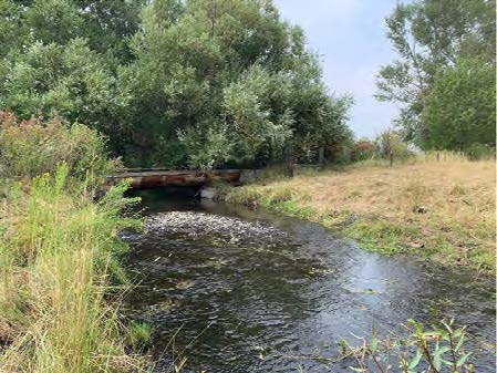
The Buffalo Flats Floodplain Restoration project is located east and adjacent to the city of Union, Oregon and within the Catherine Creek Watershed. The Project Area includes approximately 268 acres of the historic floodplain of Catherine Creek and Little Creek as they enter the Grande Ronde Valley. The proposed project area is in private ownership and has been in agricultural operations over the last century. The project is currently in the initial planning and feasibility determination phase.
Little Creek is in the design phase and further along in the planning process; Catherine Creek is still in the feasibility determination phase. Additionally, the District is working with water users, irrigators and landowners downstream of the Buffalo Flats Project area to implements the construction of new diversion structures and fish ladders on Little Creek. This concurrent project will update water delivery systems, decrease flood risk through the town of Union and also provide passage for all native species into the Buffalo Flats Project area.
Union Soil and Water Conservation District (USWCD) is the local project sponsor and is partnering with other conservation partners to provide planning and restoration actions aimed at restoring functional floodplain and stream conditions while supporting a successful ranching operation. Learn how the USWCD mission and goals relate to our restoration work in this summary.
We recognize the complexity of the natural river system and the need to minimize potential for impacts from actions on nearby areas, and will carefully consider the ramifications of design alternatives on the local community. The project will be designed to not increase the risk of flood damage or flood water elevations from the existing conditions on neighboring properties and structures and will maintain the utility of existing infrastructure.
The combination of restoration actions will be designed to meet the following project goals:
- Enhance and restore aquatic habitat conditions and increase habitat diversity and complexity for salmonids;
- Improve water quality conditions (temperature and sediment) for salmonids, other native fish, and wildlife;
- Promote conditions for restoring ecological function and improving soil health within the project area;
- Improve riparian corridor and floodplain vegetative diversity and function within the project area;
- Reconnect both Catherine Creek and Little Creek with their associated floodplains and expand quality floodplain habitat availability for salmonids within the project boundaries;
- Increase streambank and floodplain storage of water and ice; increasing the potential for attenuating flows and reducing ice formation within the project reach.
For more information, contact Jim Webster, USWCD.
This project is a partnership between Union Soil and Water Conservation District (USWCD), Bureau of Reclamation (Reclamation), Grande Ronde Model Watershed (GRMW), and the primary landowner, Buffalo Peak Land and Livestock. Additional team members include Trout Unlimited (TU), and Confederated Tribes of the Umatilla Indian Reservation (CTUIR).
Conservation Partners
Funding partners include Bonneville Power Administration (BPA) and Oregon Watershed Enhancement Board (OWEB). The partnership is also collaborating with Oregon Department of Transportation (ODOT) and Union County Roads Department to explore options for changing and improving road alignments within the project area.
Project Design Milestones
The image below describes the expected activities for each design milestone by functional area (design, funding, permitting, public outreach):
